
珲春市 훈춘시 topographic map
Interactive map
Click on the map to display elevation.
About this map
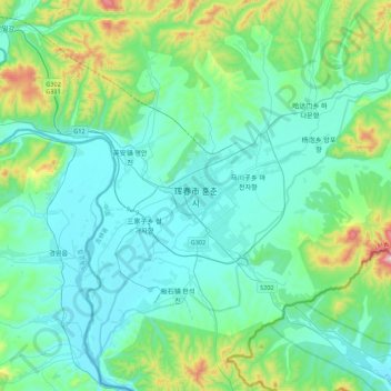
Name: 珲春市 훈춘시 topographic map, elevation, terrain.
Location: 珲春市 훈춘시, Hunchun, Yanbian, Jilin, China (42.69924 130.19910 43.01924 130.51910)
Average elevation: 141 m
Minimum elevation: 17 m
Maximum elevation: 758 m
Other topographic maps
Click on a map to view its topography, its elevation and its terrain.