
La Louinière topographic map
Interactive map
Click on the map to display elevation.
About this map
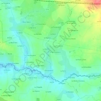
Name: La Louinière topographic map, elevation, terrain.
Average elevation: 86 m
Minimum elevation: 64 m
Maximum elevation: 135 m
Other topographic maps
Click on a map to view its topography, its elevation and its terrain.
La Croix de Bois
France > Bretagne > Ille-et-Vilaine > Le Pertre
La Croix de Bois, Le Pertre, Fougères-Vitré, Ille-et-Vilaine, Bretagne, France métropolitaine, 35370, France
Average elevation: 145 m