
夏石冲水库 topographic map
Interactive map
Click on the map to display elevation.
About this map
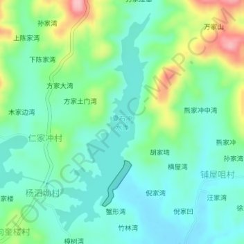
Name: 夏石冲水库 topographic map, elevation, terrain.
Location: 夏石冲水库, 樟树湾, 团风县, 黄冈市, 湖北省, 中国 (30.73554 115.06301 30.75974 115.07543)
Average elevation: 97 m
Minimum elevation: 53 m
Maximum elevation: 208 m