
Strunk topographic map
Interactive map
Click on the map to display elevation.
About this map
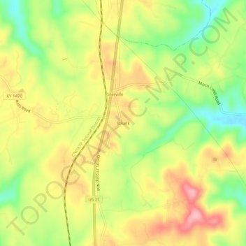
Name: Strunk topographic map, elevation, terrain.
Location: Strunk, McCreary County, Kentucky, 42649, United States (36.60202 -84.45355 36.64202 -84.41355)
Average elevation: 410 m
Minimum elevation: 334 m
Maximum elevation: 482 m