
Thank you for supporting this site ❤️
Make a donation
Make a donation
Celeste topographic map
Click on the map to display elevation.
Thank you for supporting this site ❤️
Make a donation
Make a donation
About this map
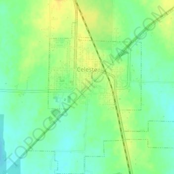
Name: Celeste topographic map, elevation, terrain.
Location: Celeste, Hunt County, Texas, United States (33.27816 -96.20748 33.30517 -96.17615)
Average elevation: 200 m
Minimum elevation: 188 m
Maximum elevation: 211 m
Thank you for supporting this site ❤️
Make a donation
Make a donation