

Putre topographic map
Click on the map to display elevation.
Putre
Putre is a Chilean town and commune, capital of the Parinacota Province in the Arica-Parinacota Region. It is located 130 km (81 mi) east of Arica, at an altitude of 3,500 m (11,483 ft). The town is backdropped by Taapaca volcanic complex.
About this map
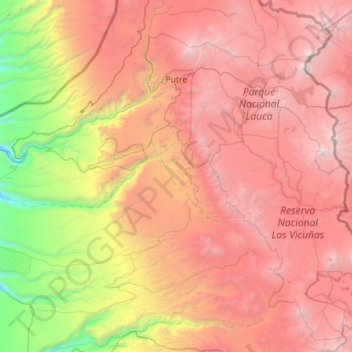
Name: Putre topographic map, elevation, terrain.
Average elevation: 3,262 m
Minimum elevation: 446 m
Maximum elevation: 6,299 m
Other topographic maps
Click on a map to view its topography, its elevation and its terrain.


Mendoza
Chile > Arica y Parinacota Region > Provincia de Parinacota > Putre
Average elevation: 3,642 m
Parinacota
Chile > Arica y Parinacota Region > Provincia de Parinacota > Putre
It is situated on the highlands at an elevation of 4,400 metres (14,400 ft) in Lauca National Park near the small town of Putre and had 29 inhabitants as of 2002.
Average elevation: 4,462 m