
Thank you for supporting this site ❤️
Make a donation
Make a donation
Bower Hill topographic map
Click on the map to display elevation.
Thank you for supporting this site ❤️
Make a donation
Make a donation
About this map
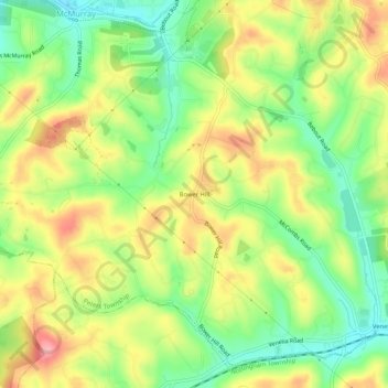
Name: Bower Hill topographic map, elevation, terrain.
Average elevation: 348 m
Minimum elevation: 295 m
Maximum elevation: 407 m
Thank you for supporting this site ❤️
Make a donation
Make a donation
Other topographic maps
Click on a map to view its topography, its elevation and its terrain.
Lake Jo-Ann
United States > Pennsylvania > Washington County > Peters Township
Average elevation: 343 m