
Longueville topographic map
Interactive map
Click on the map to display elevation.
About this map
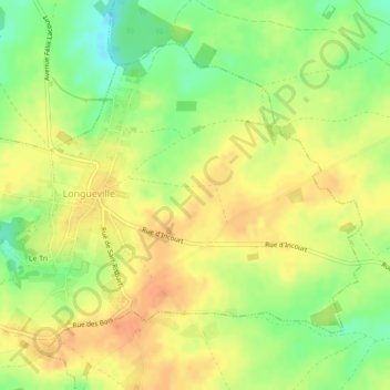
Name: Longueville topographic map, elevation, terrain.
Average elevation: 133 m
Minimum elevation: 110 m
Maximum elevation: 148 m
Other topographic maps
Click on a map to view its topography, its elevation and its terrain.
Longueville
Belgique > Brabant wallon > Chaumont-Gistoux > Longueville
Longueville, Chaumont-Gistoux, Nivelles, Brabant wallon, Wallonie, 1325, Belgique
Average elevation: 126 m