
Make a donation
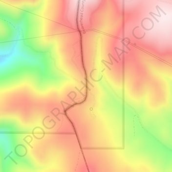
Lemhi Pass topographic map
Click on the map to display elevation.
Make a donation
Lemhi Pass
Lemhi Pass is a high mountain pass in the Beaverhead Mountains, part of the Bitterroot Range in the Rocky Mountains and within Salmon-Challis National Forest. The pass lies on the Montana-Idaho border on the Continental Divide, at an elevation of 7,373 feet (2,247 m) above sea level. It is accessed via Lemhi Pass Road in Montana, and the Lewis and Clark Highway in Idaho, both gravel roads. Warm Springs Road, which roughly follows the divide in Montana, passes just west of the pass's high point.
Make a donation
About this map
Name: Lemhi Pass topographic map, elevation, terrain.
Location: Lemhi Pass, Lemhi County, Idaho, United States (44.97457 -113.44507 44.97467 -113.44497)
Average elevation: 2,218 m
Minimum elevation: 1,936 m
Maximum elevation: 2,403 m
Make a donation
Other topographic maps
Click on a map to view its topography, its elevation and its terrain.
Salmon
United States > Idaho > Lemhi County
Salmon is located at 45°10′41″N 113°54′10″W / 45.17806°N 113.90278°W / 45.17806; -113.90278 (45.178110, –113.902660). The elevation is 3,944 feet (1,202 m) above sea level.
Average elevation: 1,247 m
Salmon
United States > Idaho > Lemhi County
Salmon is located at 45°10′41″N 113°54′10″W / 45.17806°N 113.90278°W / 45.17806; -113.90278 (45.178110, –113.902660). The elevation is 3,944 feet (1,202 m) above sea level.
Average elevation: 1,247 m