
Sanjay Gandhi (Borivilli) National Park topographic map
Interactive map
Click on the map to display elevation.
About this map
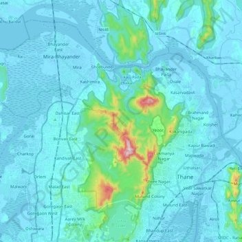
Name: Sanjay Gandhi (Borivilli) National Park topographic map, elevation, terrain.
Average elevation: 42 m
Minimum elevation: -4 m
Maximum elevation: 479 m
The region is hilly with elevations between 30 and 480 m (98 and 1,575 ft). The park has two lakes, Vihar Lake and Tulsi Lake, which meet a part of the city's water requirements. The park is said to be the lungs of the city as it purifies much of the air pollution of the city.
Other topographic maps
Click on a map to view its topography, its elevation and its terrain.
Dahisar River
India > Maharashtra > Thane > Mumbai
Dahisar River, Zone 4, Mumbai, Mumbai Metropolitan Region, Thane, Mumbai Suburban, Maharashtra, 400068, India
Average elevation: 83 m