
Yura topographic map
Interactive map
Click on the map to display elevation.
About this map
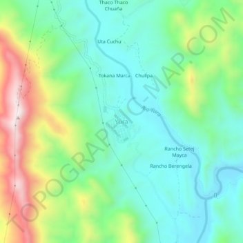
Name: Yura topographic map, elevation, terrain.
Location: Yura, Provincia Antonio Quijarro, PSI, Bolivia (-20.09322 -66.14505 -20.05322 -66.10505)
Average elevation: 3,464 m
Minimum elevation: 3,283 m
Maximum elevation: 3,873 m