
宁中乡 topographic map
Interactive map
Click on the map to display elevation.
About this map
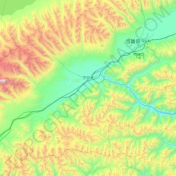
Name: 宁中乡 topographic map, elevation, terrain.
Location: 宁中乡, 当雄县, 拉萨市, 西藏自治区, 中国 (30.12002 90.49413 30.56827 91.14174)
Average elevation: 4,955 m
Minimum elevation: 4,099 m
Maximum elevation: 6,974 m
Other topographic maps
Click on a map to view its topography, its elevation and its terrain.