
Drense topographic map
Interactive map
Click on the map to display elevation.
About this map
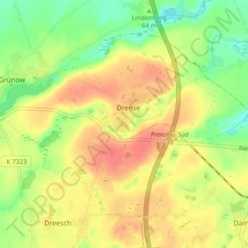
Name: Drense topographic map, elevation, terrain.
Location: Drense, Grünow, Gramzow, Uckermark, Brandenburg, Deutschland (53.29487 13.94764 53.32436 14.01388)
Average elevation: 67 m
Minimum elevation: 41 m
Maximum elevation: 88 m