
Taquile topographic map
Interactive map
Click on the map to display elevation.
About this map
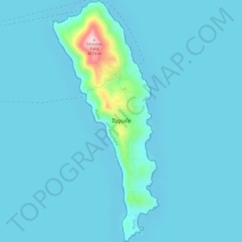
Name: Taquile topographic map, elevation, terrain.
Location: Taquile, Amantaní, Puno, Perú (-15.79880 -69.69829 -15.74964 -69.67584)
Average elevation: 3,829 m
Minimum elevation: 3,808 m
Maximum elevation: 4,071 m
Other topographic maps
Click on a map to view its topography, its elevation and its terrain.