
Judith Gap topographic map
Interactive map
Click on the map to display elevation.
About this map
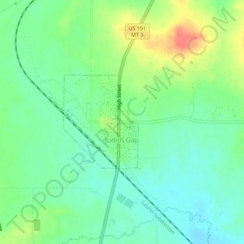
Name: Judith Gap topographic map, elevation, terrain.
Average elevation: 1,406 m
Minimum elevation: 1,386 m
Maximum elevation: 1,442 m
Because of its topography and prevailing winds, Judith Gap is the site of one of the most ambitious wind power projects in the United States. The 90 wind turbines at the Judith Gap Wind Farm have a nameplate capacity of 135 MW.
Other topographic maps
Click on a map to view its topography, its elevation and its terrain.
Harlowton
United States > Montana > Wheatland County
Harlowton, Wheatland County, Montana, United States
Average elevation: 1,286 m