
Make a donation
Eupen topographic map
Click on the map to display elevation.
Make a donation
Eupen
Eupen has a cool oceanic climate with some continental influences due to it being elevated in comparison to most of Belgium. Eupen is also wetter and cloudier than Liège in the valley to the west, as a result of orographic lift due to the elevation change. As a result of this along with frequent winter frosts, Eupen gets a significant snowfall amount by Belgian standards. It also gets 16 ice days on average each year, as in the day staying below 0 °C (32 °F), along with 71 frost days.
Make a donation
About this map
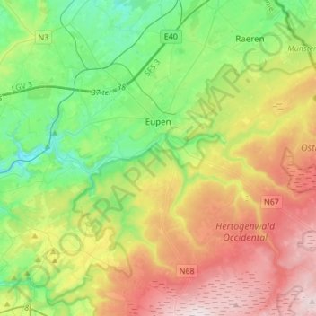
Name: Eupen topographic map, elevation, terrain.
Location: Eupen, Verviers, Liège, Wallonia, Belgium (50.54802 6.00060 50.67287 6.27411)
Average elevation: 368 m
Minimum elevation: 180 m
Maximum elevation: 672 m
Make a donation
Other topographic maps
Click on a map to view its topography, its elevation and its terrain.