
Canteloube topographic map
Interactive map
Click on the map to display elevation.
About this map
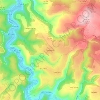
Name: Canteloube topographic map, elevation, terrain.
Average elevation: 225 m
Minimum elevation: 96 m
Maximum elevation: 356 m
Other topographic maps
Click on a map to view its topography, its elevation and its terrain.
Le Bougayrou
France > Occitanie > Lot > Lacave
Le Bougayrou, Lacave, Gourdon, Lot, Occitanie, France métropolitaine, 46200, France
Average elevation: 165 m
Les Bertoux
France > Occitanie > Lot > Lacave
Les Bertoux, Lacave, Gourdon, Lot, Occitanie, France métropolitaine, 46200, France
Average elevation: 181 m