
Thank you for supporting this site ❤️
Make a donation
Make a donation
Scandia topographic map
Click on the map to display elevation.
Thank you for supporting this site ❤️
Make a donation
Make a donation
About this map
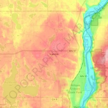
Name: Scandia topographic map, elevation, terrain.
Location: Scandia, Washington County, Minnesota, 55073, United States (45.20971 -92.89821 45.29646 -92.74459)
Average elevation: 284 m
Minimum elevation: 204 m
Maximum elevation: 344 m
Thank you for supporting this site ❤️
Make a donation
Make a donation