
Thank you for supporting this site ❤️
Make a donation
Make a donation
Emmerthal topographic map
Click on the map to display elevation.
Thank you for supporting this site ❤️
Make a donation
Make a donation
About this map
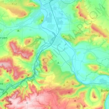
Name: Emmerthal topographic map, elevation, terrain.
Average elevation: 160 m
Minimum elevation: 63 m
Maximum elevation: 376 m
Thank you for supporting this site ❤️
Make a donation
Make a donation
Other topographic maps
Click on a map to view its topography, its elevation and its terrain.
Coppenbrügge
Duitsland > Nedersaksen > Landkreis Hameln-Pyrmont > Coppenbrügge > Coppenbrügge
Average elevation: 182 m