
穆阳镇 topographic map
Interactive map
Click on the map to display elevation.
About this map
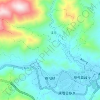
Name: 穆阳镇 topographic map, elevation, terrain.
Location: 穆阳镇, 福安市, 宁德市, 福建省, 中国 (27.05360 119.48098 27.09995 119.54466)
Average elevation: 240 m
Minimum elevation: 21 m
Maximum elevation: 981 m
Other topographic maps
Click on a map to view its topography, its elevation and its terrain.