
Siegenburg topographic map
Interactive map
Click on the map to display elevation.
About this map
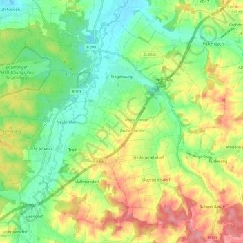
Name: Siegenburg topographic map, elevation, terrain.
Average elevation: 419 m
Minimum elevation: 371 m
Maximum elevation: 487 m
Other topographic maps
Click on a map to view its topography, its elevation and its terrain.
Train
Germany > Bavaria > Landkreis Kelheim
Train, Siegenburg (VGem), Landkreis Kelheim, Bavaria, 93358, Germany
Average elevation: 419 m
Kelheim
Germany > Bavaria > Landkreis Kelheim > Kelheim
Kelheim, Landkreis Kelheim, Bavaria, 93309, Germany
Average elevation: 423 m