
Thank you for supporting this site ❤️
Make a donation
Make a donation
Monte Capra topographic map
Click on the map to display elevation.
Thank you for supporting this site ❤️
Make a donation
Make a donation
About this map
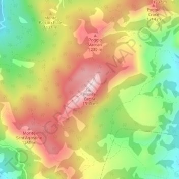
Name: Monte Capra topographic map, elevation, terrain.
Location: Monte Capra, Coli, Piacenza, Emilia-Romagna, Italia (44.75240 9.46231 44.75250 9.46241)
Average elevation: 1,079 m
Minimum elevation: 865 m
Maximum elevation: 1,285 m
Thank you for supporting this site ❤️
Make a donation
Make a donation