
Aïn Benian topographic map
Interactive map
Click on the map to display elevation.
About this map
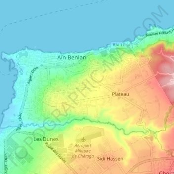
Name: Aïn Benian topographic map, elevation, terrain.
Location: Aïn Benian, Daïra Cheraga, Alger, 16202, Algérie (36.77902 2.89325 36.80876 2.96157)
Average elevation: 58 m
Minimum elevation: 0 m
Maximum elevation: 180 m
Other topographic maps
Click on a map to view its topography, its elevation and its terrain.