
王稳庄镇 topographic map
Interactive map
Click on the map to display elevation.
About this map
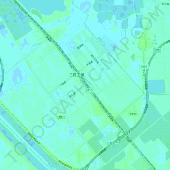
Name: 王稳庄镇 topographic map, elevation, terrain.
Location: 王稳庄镇, 西青区, 天津市, 中国 (38.84976 117.22418 38.92976 117.30418)
Average elevation: 3 m
Minimum elevation: -2 m
Maximum elevation: 9 m
Other topographic maps
Click on a map to view its topography, its elevation and its terrain.