
La Côte topographic map
Interactive map
Click on the map to display elevation.
About this map
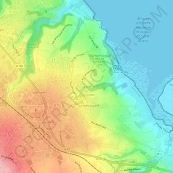
Name: La Côte topographic map, elevation, terrain.
Average elevation: 55 m
Minimum elevation: -1 m
Maximum elevation: 137 m
Other topographic maps
Click on a map to view its topography, its elevation and its terrain.
Bout de Ville
France > Bretagne > Côtes-d'Armor > Langueux
Bout de Ville, Langueux, Saint-Brieuc, Côtes-d'Armor, Bretagne, France métropolitaine, 22360, France
Average elevation: 36 m
La Roche Durand
France > Bretagne > Côtes-d'Armor > Langueux > La Roche Durand
La Roche Durand, Langueux, Saint-Brieuc, Côtes-d'Armor, Bretagne, France métropolitaine, 22360, France
Average elevation: 61 m