
Thank you for supporting this site ❤️
Make a donation
Make a donation
Mouland topographic map
Click on the map to display elevation.
Thank you for supporting this site ❤️
Make a donation
Make a donation
About this map
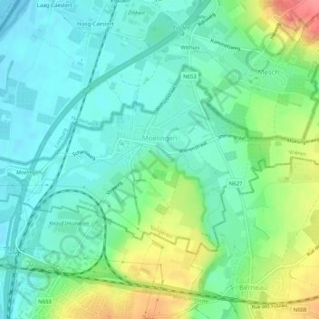
Name: Mouland topographic map, elevation, terrain.
Location: Mouland, Fourons, Tongres, Limbourg, Flandre, Belgique (50.74571 5.68217 50.76472 5.73288)
Average elevation: 73 m
Minimum elevation: 50 m
Maximum elevation: 126 m
Thank you for supporting this site ❤️
Make a donation
Make a donation
Other topographic maps
Click on a map to view its topography, its elevation and its terrain.
Thank you for supporting this site ❤️
Make a donation
Make a donation
Thank you for supporting this site ❤️
Make a donation
Make a donation