
Thank you for supporting this site ❤️
Make a donation
Make a donation
Eastport topographic map
Click on the map to display elevation.
Thank you for supporting this site ❤️
Make a donation
Make a donation
About this map
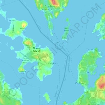
Name: Eastport topographic map, elevation, terrain.
Location: Eastport, Washington County, Maine, 04631, United States (44.87387 -67.05227 44.95243 -66.96870)
Average elevation: 8 m
Minimum elevation: -1 m
Maximum elevation: 84 m
Thank you for supporting this site ❤️
Make a donation
Make a donation
Other topographic maps
Click on a map to view its topography, its elevation and its terrain.
Thank you for supporting this site ❤️
Make a donation
Make a donation
Thank you for supporting this site ❤️
Make a donation
Make a donation
Thank you for supporting this site ❤️
Make a donation
Make a donation