
Reinsfeld topographic map
Interactive map
Click on the map to display elevation.
About this map
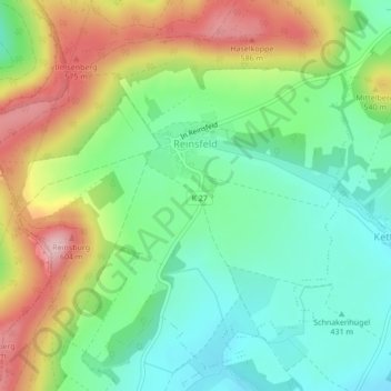
Name: Reinsfeld topographic map, elevation, terrain.
Location: Reinsfeld, Arnstadt, Ilm-Kreis, Thüringen, Deutschland (50.76042 10.92829 50.78427 10.96953)
Average elevation: 478 m
Minimum elevation: 402 m
Maximum elevation: 601 m