
Thank you for supporting this site ❤️
Make a donation
Make a donation
Cerdedo topographic map
Click on the map to display elevation.
Thank you for supporting this site ❤️
Make a donation
Make a donation
About this map
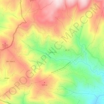
Name: Cerdedo topographic map, elevation, terrain.
Location: Cerdedo, Boticas, Vila Real, Portugal (41.63850 -7.89994 41.67850 -7.85994)
Average elevation: 942 m
Minimum elevation: 670 m
Maximum elevation: 1,183 m
Thank you for supporting this site ❤️
Make a donation
Make a donation