
Le Chalange topographic map
Interactive map
Click on the map to display elevation.
About this map
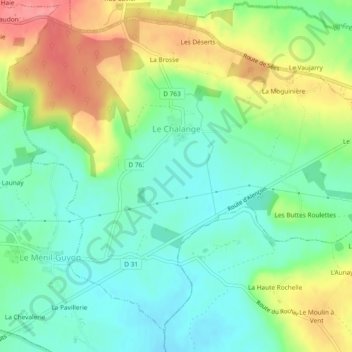
Name: Le Chalange topographic map, elevation, terrain.
Average elevation: 189 m
Minimum elevation: 158 m
Maximum elevation: 241 m
Other topographic maps
Click on a map to view its topography, its elevation and its terrain.
Les Déserts
France > Normandie > Orne > Le Chalange > Les Déserts
Les Déserts, Le Chalange, Alençon, Orne, Normandie, France métropolitaine, 61390, France
Average elevation: 201 m