
热河南路街道 topographic map
Interactive map
Click on the map to display elevation.
About this map
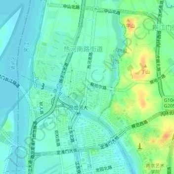
Name: 热河南路街道 topographic map, elevation, terrain.
Location: 热河南路街道, 鼓楼区, 南京市, 江苏省, 中国 (32.06461 118.72266 32.08921 118.74289)
Average elevation: 11 m
Minimum elevation: 1 m
Maximum elevation: 35 m
Other topographic maps
Click on a map to view its topography, its elevation and its terrain.