
Thank you for supporting this site ❤️
Make a donation
Make a donation
Canfranc topographic map
Click on the map to display elevation.
Thank you for supporting this site ❤️
Make a donation
Make a donation
About this map
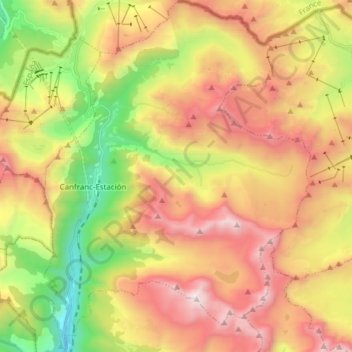
Name: Canfranc topographic map, elevation, terrain.
Location: Canfranc, La Jacetania, Huesca, Aragonien, 22880, Spanien (42.69725 -0.53755 42.80944 -0.42112)
Average elevation: 1,928 m
Minimum elevation: 994 m
Maximum elevation: 2,872 m
Thank you for supporting this site ❤️
Make a donation
Make a donation
Other topographic maps
Click on a map to view its topography, its elevation and its terrain.