
Thank you for supporting this site ❤️
Make a donation
Make a donation
Banbana topographic map
Click on the map to display elevation.
Thank you for supporting this site ❤️
Make a donation
Make a donation
About this map
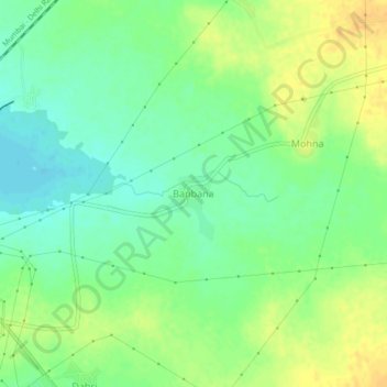
Name: Banbana topographic map, elevation, terrain.
Location: Banbana, Nagda Tahsil, Nagda, Madhya Pradesh, 456335, India (23.43433 75.44794 23.47433 75.48794)
Average elevation: 488 m
Minimum elevation: 474 m
Maximum elevation: 503 m
Thank you for supporting this site ❤️
Make a donation
Make a donation
Other topographic maps
Click on a map to view its topography, its elevation and its terrain.