
Süderholm topographic map
Interactive map
Click on the map to display elevation.
About this map
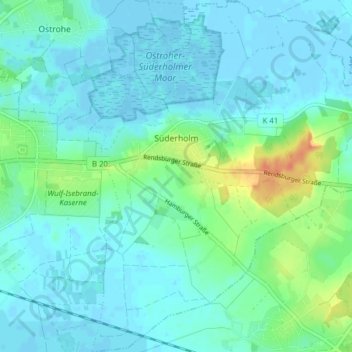
Name: Süderholm topographic map, elevation, terrain.
Location: Süderholm, Heide, Dithmarschen, Schleswig-Holstein, Deutschland (54.17283 9.13612 54.21828 9.21301)
Average elevation: 8 m
Minimum elevation: -4 m
Maximum elevation: 39 m