
Thank you for supporting this site ❤️
Make a donation
Make a donation
Praia do Pintadinho topographic map
Click on the map to display elevation.
Thank you for supporting this site ❤️
Make a donation
Make a donation
About this map
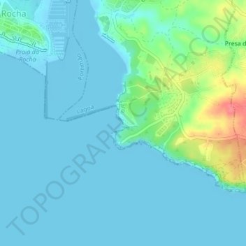
Name: Praia do Pintadinho topographic map, elevation, terrain.
Location: Praia do Pintadinho, Ferragudo, Lagoa, Faro, Portugal (37.10737 -8.51965 37.10873 -8.51824)
Average elevation: 12 m
Minimum elevation: -2 m
Maximum elevation: 68 m
Thank you for supporting this site ❤️
Make a donation
Make a donation