
Thank you for supporting this site ❤️
Make a donation
Make a donation
Cedar City topographic map
Click on the map to display elevation.
Thank you for supporting this site ❤️
Make a donation
Make a donation
About this map
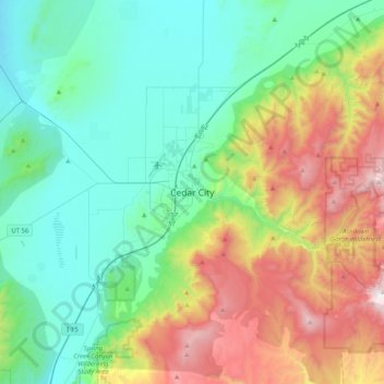
Name: Cedar City topographic map, elevation, terrain.
Location: Cedar City, Iron County, Utah, 84720, United States (37.51742 -113.22183 37.83742 -112.90183)
Average elevation: 2,087 m
Minimum elevation: 1,615 m
Maximum elevation: 3,259 m
Thank you for supporting this site ❤️
Make a donation
Make a donation