
Thank you for supporting this site ❤️
Make a donation
Make a donation
Frederick topographic map
Click on the map to display elevation.
Thank you for supporting this site ❤️
Make a donation
Make a donation
About this map
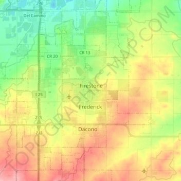
Name: Frederick topographic map, elevation, terrain.
Location: Frederick, Weld County, Colorado, United States (40.08038 -105.03757 40.13868 -104.88645)
Average elevation: 1,519 m
Minimum elevation: 1,468 m
Maximum elevation: 1,580 m
Thank you for supporting this site ❤️
Make a donation
Make a donation
Other topographic maps
Click on a map to view its topography, its elevation and its terrain.