
Thank you for supporting this site ❤️
Make a donation
Make a donation
Lamorteau topographic map
Click on the map to display elevation.
Thank you for supporting this site ❤️
Make a donation
Make a donation
About this map
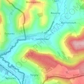
Name: Lamorteau topographic map, elevation, terrain.
Location: Lamorteau, Rouvroy, Virton, Luxembourg, Wallonie, 6767, Belgique (49.51181 5.45543 49.53774 5.51923)
Average elevation: 247 m
Minimum elevation: 184 m
Maximum elevation: 360 m
Thank you for supporting this site ❤️
Make a donation
Make a donation