
Puig d'En Vidal topographic map
Interactive map
Click on the map to display elevation.
About this map
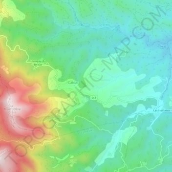
Name: Puig d'En Vidal topographic map, elevation, terrain.
Average elevation: 378 m
Minimum elevation: 199 m
Maximum elevation: 779 m
Other topographic maps
Click on a map to view its topography, its elevation and its terrain.
Hameau du Beinat
France > Occitanie > Pyrénées-Orientales > Caixas
Hameau du Beinat, Caixas, Céret, Pyrénées-Orientales, Occitanie, France métropolitaine, 66300, France
Average elevation: 453 m