
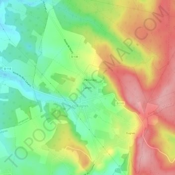
Langle topographic map
Interactive map
Click on the map to display elevation.
About this map
Name: Langle topographic map, elevation, terrain.
Average elevation: 268 m
Minimum elevation: 202 m
Maximum elevation: 344 m
Other topographic maps
Click on a map to view its topography, its elevation and its terrain.
Champ de l'Allier
France > Bourgogne-Franche-Comté > Nièvre > Chaulgnes
Champ de l'Allier, Chaulgnes, Cosne-Cours-sur-Loire, Nièvre, Bourgogne-Franche-Comté, France métropolitaine, 58400, France
Average elevation: 249 m
Chalon
France > Bourgogne-Franche-Comté > Nièvre > Chaulgnes > Le Chazeau
Chalon, Le Chazeau, Chaulgnes, Cosne-Cours-sur-Loire, Nièvre, Bourgogne-Franche-Comté, France métropolitaine, 58400, France
Average elevation: 242 m