
Guillemont topographic map
Interactive map
Click on the map to display elevation.
About this map
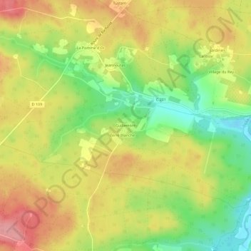
Name: Guillemont topographic map, elevation, terrain.
Average elevation: 110 m
Minimum elevation: 52 m
Maximum elevation: 162 m
Other topographic maps
Click on a map to view its topography, its elevation and its terrain.
Réaup
France > Nouvelle-Aquitaine > Lot-et-Garonne > Réaup-Lisse
Réaup, Réaup-Lisse, Nérac, Lot-et-Garonne, Nouvelle-Aquitaine, France métropolitaine, 47170, France
Average elevation: 138 m
Cieuse
France > Nouvelle-Aquitaine > Lot-et-Garonne > Réaup-Lisse
Cieuse, Réaup-Lisse, Nérac, Lot-et-Garonne, Nouvelle-Aquitaine, France métropolitaine, 47170, France
Average elevation: 103 m