
Le Val Adam topographic map
Interactive map
Click on the map to display elevation.
About this map
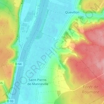
Name: Le Val Adam topographic map, elevation, terrain.
Average elevation: 47 m
Minimum elevation: 0 m
Maximum elevation: 127 m
Other topographic maps
Click on a map to view its topography, its elevation and its terrain.
La Marguerite
France > Normandie > Seine-Maritime > Saint-Pierre-de-Manneville
La Marguerite, Saint-Pierre-de-Manneville, Rouen, Seine-Maritime, Normandie, France métropolitaine, 76113, France
Average elevation: 47 m