
Les Goutelaines topographic map
Interactive map
Click on the map to display elevation.
About this map
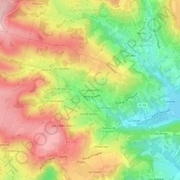
Name: Les Goutelaines topographic map, elevation, terrain.
Average elevation: 350 m
Minimum elevation: 243 m
Maximum elevation: 453 m
Other topographic maps
Click on a map to view its topography, its elevation and its terrain.
Chalencey
France > Bourgogne-Franche-Comté > Saône-et-Loire > Couches
Chalencey, Couches, Autun, Saône-et-Loire, Bourgogne-Franche-Comté, France métropolitaine, 71490, France
Average elevation: 323 m
La Barre
France > Bourgogne-Franche-Comté > Saône-et-Loire > Couches > La Barre
La Barre, Couches, Autun, Saône-et-Loire, Bourgogne-Franche-Comté, France métropolitaine, 71490, France
Average elevation: 339 m