
Suwannee County topographic map
Interactive map
Click on the map to display elevation.
About this map
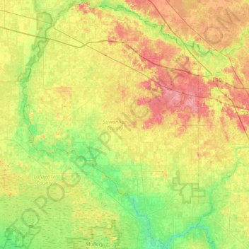
Name: Suwannee County topographic map, elevation, terrain.
Location: Suwannee County, Florida, Estados Unidos de América (29.88220 -83.25336 30.44287 -82.75858)
Average elevation: 27 m
Minimum elevation: 1 m
Maximum elevation: 63 m