
Village of Champion topographic map
Interactive map
Click on the map to display elevation.
About this map
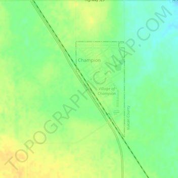
Name: Village of Champion topographic map, elevation, terrain.
Location: Village of Champion, Alberta, Canada (50.23105 -113.15468 50.24554 -113.14315)
Average elevation: 962 m
Minimum elevation: 948 m
Maximum elevation: 973 m
Other topographic maps
Click on a map to view its topography, its elevation and its terrain.
Jenner
Canada > Alberta > Special Area No. 2
Jenner, Special Area No. 2, Alberta, Canada
Average elevation: 750 m
Drumheller (town)
Drumheller (town), Alberta, T0J 2V0, Canada
Average elevation: 855 m
Kananaskis Improvement District
Kananaskis Improvement District, Alberta, Canada
Average elevation: 1,740 m
South Kootenay Pass
South Kootenay Pass, Mount Rowe to Sage Pass Route, Regional District of East Kootenay, Alberta, Canada
Average elevation: 2,007 m
Rivière Saskatchewan Nord
Rivière Saskatchewan Nord, County of Two Hills, Alberta, T5N 1J9, Canada
Average elevation: 833 m
North Cooking Lake
Canada > Alberta > North Cooking Lake
North Cooking Lake, Comté de Strathcona, Alberta, Canada
Average elevation: 745 m
Rivière de la Paix
Canada > Alberta > Peace River
Rivière de la Paix, Highway 2, Coolsprings Mobile Home Park, Shaftesbury Estates, Peace River, Alberta, T8S 1H8, Canada
Average elevation: 350 m
Sylvan Lake
Canada > Alberta > Sylvan Lake
Sylvan Lake, Town of Sylvan Lake, Alberta, T4S 1S3, Canada
Average elevation: 957 m