
Tīnūžu pagasts topographic map
Interactive map
Click on the map to display elevation.
About this map
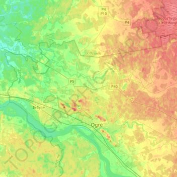
Name: Tīnūžu pagasts topographic map, elevation, terrain.
Location: Tīnūžu pagasts, Ogres novads, Zemgale, LV-5052, Letland (56.80627 24.43259 56.90686 24.76824)
Average elevation: 34 m
Minimum elevation: 4 m
Maximum elevation: 70 m