
Hacquegnies topographic map
Interactive map
Click on the map to display elevation.
About this map
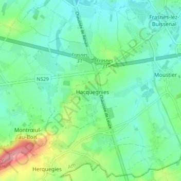
Name: Hacquegnies topographic map, elevation, terrain.
Location: Hacquegnies, Aat, Henegouwen, Wallonië, 7911, België (50.63224 3.57385 50.67224 3.61385)
Average elevation: 52 m
Minimum elevation: 25 m
Maximum elevation: 126 m