སྲོ་སྣང་ topographic map
Interactive map
Click on the map to display elevation.
About this map
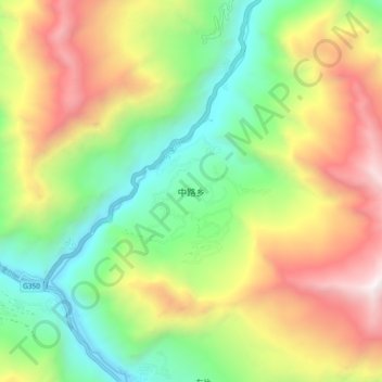
Name: སྲོ་སྣང་ topographic map, elevation, terrain.
Average elevation: 2,760 m
Minimum elevation: 1,841 m
Maximum elevation: 4,066 m

Click on the map to display elevation.
Name: སྲོ་སྣང་ topographic map, elevation, terrain.
Average elevation: 2,760 m
Minimum elevation: 1,841 m
Maximum elevation: 4,066 m