
Thank you for supporting this site ❤️
Make a donation
Make a donation
Covello topographic map
Click on the map to display elevation.
Thank you for supporting this site ❤️
Make a donation
Make a donation
About this map
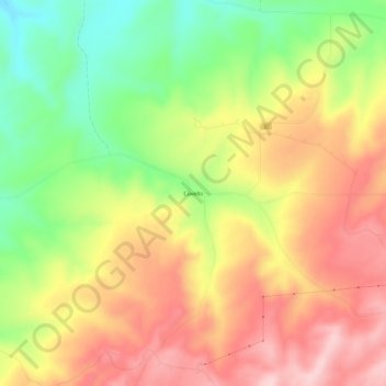
Name: Covello topographic map, elevation, terrain.
Location: Covello, Columbia County, Washington, United States (46.36320 -117.85298 46.40320 -117.81298)
Average elevation: 783 m
Minimum elevation: 657 m
Maximum elevation: 895 m
Thank you for supporting this site ❤️
Make a donation
Make a donation
Other topographic maps
Click on a map to view its topography, its elevation and its terrain.