
Thank you for supporting this site ❤️
Make a donation
Make a donation
Irumbai topographic map
Click on the map to display elevation.
Thank you for supporting this site ❤️
Make a donation
Make a donation
About this map
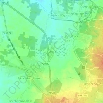
Name: Irumbai topographic map, elevation, terrain.
Location: Irumbai, Vanur, Viluppuram District, Tamil Nadu, 605111, India (11.98662 79.76722 12.02662 79.80722)
Average elevation: 37 m
Minimum elevation: 20 m
Maximum elevation: 59 m
Thank you for supporting this site ❤️
Make a donation
Make a donation
Other topographic maps
Click on a map to view its topography, its elevation and its terrain.